
For reference, for your consideration as you do your own research, for your use if you decide to contribute material to Groceteria.com, or just in case you’re interested in how I do my research, these are some of the conventions, tips, and tricks I use when doing location research for the site.
There are many ways to handle this kind of research. There is no “best” way, but this is my way, and it’s the way I will continue doing it. That’s not really up for discussion. Your mileage and approach may vary and that’s fine. It will never be complete enough or rigorous enough for some people, and I’m OK with that too (though it would be nice if any complaints were constructive and polite and recognized the considerable work that goes into the project). This is my hobby. It’s not my job, and I do not get paid to do this, so obviously I’m going to do it my own way.
You can access my master Google Sheets template here. It will automatically populate a Google Maps link based on the address you enter, among other things.
A few important conventions and policies
- I only research chains. This includes local chains and independent stores that are members of a branded group, like IGA, but not one-off independent stores. In a large city, there are hundreds or thousands of independent stores over the course of a century. That’s too many, and it’s not really my area of interest, so this is not really a debatable point.
- My goal is NOT to try to find every location of any given chain, but to trace development through snapshots of what was where in a given city at a given time (usually as close as I can come to five-year intervals).
- I use other sources (newspaper ads, phone books, other databases) as a backup or fill-in if I have time and acccess, particularly if I sense there are gaps in the city directories. But again, city directories are my primary source and are ALWAYS my starting point. I do not start working on a city without access to these directories.
- Address lists must be sourced for accuracy and completeness. It’s OK to augment with specific memories and knowledge but the research should be based on city directories and not telephone directories (see “Using city directories” below).
- My focus is on consistency even more than completeness. Only full years should be included. If I only have scattered addresses (or do not have addresses for every chain) for a given year, I generally skip that year unless I can fill in the information through other sources. There are exceptions. Ask. Please.
- Unless there is some special relevance, I do not include subsequent non-grocery tenants (e.g. listing Safeway in 1975 and Big Lots in 1980) unless there’s some relevance (like same ownership) or unless I’m doing a list of the current tenants for reference purposes.
- I always list the location under the current address for mapping purposes. Old/changed/renumbered addresses are listed in the notes. This is, actually, one of the most interesting and time-consuming parts of the process as it involves locating old maps, using the address sections of the directories, etc. What can I say? I was a geography major.
- I do not include convenience stores, liquor stores, etc.
Using city directories
- I use city directories exclusively as my starting point (e.g. Polk, Donnelly, Hill, Might, etc.), examining them at five-year intervals (or as close as possible) usually starting with the mid-1920s. These “snapshots” at five-year intervals may mean missing a stray location or two, or in some cases a very short-lived chain.
- Telephone directories are NOT reliable resources (they are very incomplete and often do not include whole chains, such as Safeway). They should only be used to bridge gaps, if at all.
- The categories to look at are generally some variation on:
- Grocers
- Grocers – Retail
- Grocers and Markets
- Groceries and Meats
- Markets
- It’s very important to make sure the area covered is consistent over time. In some cases, suburbs may be included in the “main” city directory to begin with and then in a separate one later. In some cases, the city itself may be split into multiple directories as it grows. If there are suburbs for whom the dates differ, I generally create a separate spreadsheet for the suburbs.
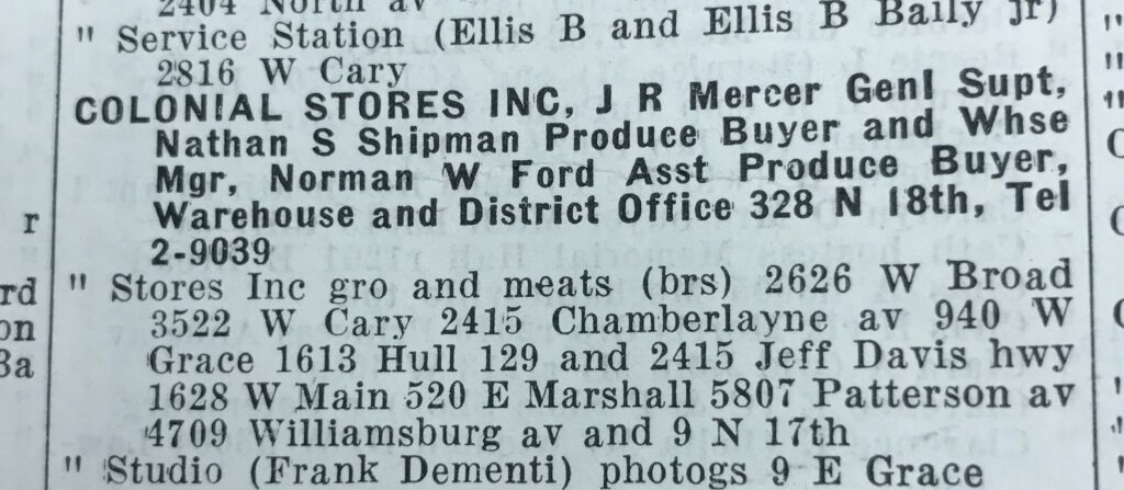
- In many city directories, the listing for a large chain may prompt users to look in the alphabetical section for the full listing. This is especially common between 1930 and 1970.
- Co-ops and franchises (e.g. IGA or Foodland) are often listed under the owner’s name or other identifier rather than the name of the co-op (e.g. Herb’s IGA or Main Street Foodland).
- Usually city directories have a page listing the abbreviations used for suburbs and major roads. Other conventions include:
- Street names not followed by “Av, Rd, Blvd, etc.” are generally “streets”. That is the default. It’s important to pay attention to this, especially on numbered streets. Sometimes there may be numbered streets and avenues, or maybe a Park Avenue and a Park Road.
- Pay attention to direction indicators (e.g. East Market Street).
- The abbreviation “do” means “ditto” (same as the one above).
- Often the first address listed is an office or warehouse, but this is not always clear from the listing.
What is a chain?
- Depending on the size of the city, a “chain” is usually defined as three or more stores in the early years.
- In later years, there may be only one location of a chain in smaller cities; I go with names I know from my own experience or from research on nearby cities.
- Many chains constrict over time. If something was a chain at some point, I keep listing it even if it dwindles to only one location.
Oddities
- Co-op stores (IGA, Red & White, etc.) are often listed under the owner’s name (e.g. “Smith’s IGA”) so it’s important to look closely to catch these.
- A&P may be listed under “Great Atlantic and Pacific,” “Atlantic and Pacific,” or “A&P” (and sometimes a combination).
- Street names change over time. Sometimes it’s easy to figure this out. Sometimes not so much. I try to list the current address, with any older versions noted in the “notes” column. This enables the Google Maps search. Most city directories include a street guide which may help you locate where renamed streets/numbers were so that you can figure out the current equivalent.
- Stores often expand into the neighboring unit, especially before 1950 or so. If the new address in incremented just by 2 (e.g. 346 becomes 344 or 348), I generally assume this is what has happened and consolidate the two addresses. I also note any changes in the “notes” field. (e.g. “346 in 1930, 348 in 1935, 346-350 in 1940.”)
- Sometimes it helps to back-check addresses using the reverse-lookup section, particularly if there is a gap in the address history.
- Sometimes addresses are listed simply as an intersection. In this case, I try to determine (or at least estimate) the street address by looking at a contemporary view in Google Maps or by looking in the reverse-lookup section.
- Listings also sometimes alternate between naming a street address and naming a shopping center.